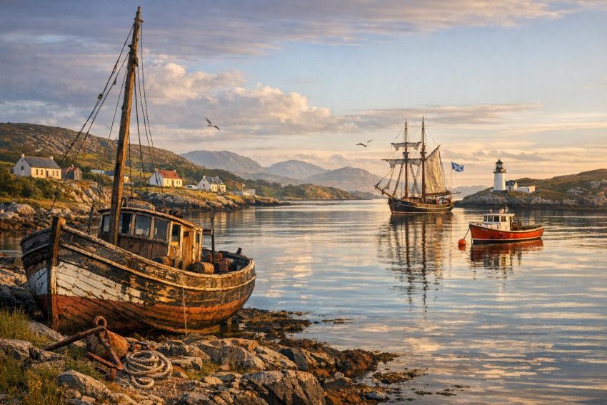
Scalpay is a small island in the Outer Hebrides, lying off the east coast of Harris in the Minch. Its Gaelic name, Eilean Scalpaigh, is commonly linked with an Old Norse term interpreted as “island of ships” or “island of boats”. Linguists do not agree on every detail of that derivation, but the association suits an island whose settlement, employment and transport depended heavily on the sea.
A narrow channel, Scalpay Sound, separates the island from Harris. Before the opening of the road bridge in 1997, that short stretch of water shaped almost every practical connection with Harris. People, livestock, fuel, mail, building materials and groceries had to cross by boat. The distance was modest; the logistics were not. Wind, tide, visibility and the availability of a suitable vessel could turn a routine crossing into a delayed one.
Scalpay’s maritime history is not centred on a large harbour, naval base or transatlantic shipping terminal. It is a history of working boats, local fisheries, ferry services, lighthouse operations and household economies built around both land and water. The island’s residents fished, gathered seaweed, maintained crofts and travelled for seasonal employment. Maritime knowledge was therefore an ordinary working skill rather than a separate profession reserved for a few seamen.
Scalpay’s Position in the Minch
Scalpay occupies a useful position beside the east coast of Harris. The Minch lies to the east, separating the Outer Hebrides from mainland Scotland and the Inner Hebrides. Vessels moving through these waters encounter open stretches, narrow passages, tidal streams and shores broken by rocks, bays and headlands. The sea can change rapidly, particularly when wind runs against tide.
The island’s coastline contains sheltered inlets as well as exposed rocky sections. Small boats could use bays and natural landing places according to wind direction and sea state. No anchorage was suitable in every condition, so local crews learned which side of the island offered the safer approach on a given day. That judgement came from repeated observation rather than from charts alone.
Land suitable for crops is scarce, and the weather restricts what can be grown reliably. Crofting still supplied potatoes, oats, milk, meat and wool at various periods, but few households could depend on agriculture alone. Fishing and shore work supplemented food production and provided cash. This combination of crofting, fishing and paid labour was common across the Outer Hebrides.
The coast also supplied resources that rarely appear in formal shipping records. Residents collected shellfish for food, seaweed for fertiliser and driftwood for fuel or repairs. Stranded timber had value in a district with little native woodland. Even material washed ashore could become a roof beam, fence post, oar or part of a shed. Nothing useful was discarded without a fair bit of thought.
Scalpay Sound served both as a route and a boundary. It connected island residents with Harris, yet it also imposed a daily transport problem. A person on Scalpay could see Harris at close range but still depend on a boatman, a safe landing and workable weather. That tension between proximity and separation remained part of island life until the bridge opened.
Early Coastal Settlement
People have occupied the Hebrides since prehistoric times, relying on farming, fishing, hunting and shoreline resources. Archaeological evidence from smaller inhabited islands can be uneven. Houses, cultivation, peat cutting and later construction often disturbed earlier deposits, while coastal erosion removed material before it could be recorded.
Scalpay’s location nevertheless places it within a long pattern of settlement based on access to both grazing land and sheltered water. A coastal household needed more than a place to build. It required access to fresh water, fuel, workable soil, grazing and a landing point where a boat could be drawn up or secured. The distribution of settlement was closely connected to those practical needs.
Early fishing probably concentrated on nearby waters and species that could be caught with handlines, nets, traps or hooks. Fish could be eaten fresh, but preserving methods mattered where catches exceeded immediate household demand. Drying, salting and smoking extended storage time, although salt could be costly. Shellfish offered another dependable food source and could be gathered without owning a large vessel.
Travel between islands was normal rather than exceptional. Religious sites, family connections and trading contacts spread across the Hebrides, making the sea a transport corridor. Paths on land often ended at a beach or inlet, where the next stage of a trip began by boat. Modern maps encourage people to view water as the gap between places; for island communities, it was often the road between them.
Norse Rule and Maritime Connections
From the late eighth century onward, Norse raiders, settlers and traders became active throughout western Scotland. Over time, Norse authority extended across much of the Hebrides. These islands formed part of a network connecting Norway, Ireland, the Isle of Man, northern Britain, Iceland and other North Atlantic settlements.
Norse boats were suited to coasts where crews needed to cross open water and enter shallow bays. Depending on size and purpose, vessels could carry people, animals, timber, food and traded goods. Oars allowed movement in calm conditions or confined channels, while sails made longer passages more efficient. The same basic qualities also suited local transport within the Hebrides.
Place-names provide some of the clearest evidence of Norse settlement and influence. Names associated with bays, islands, headlands, farms and channels often preserve Old Norse roots, even where Gaelic later became dominant. Scalpay’s name is commonly connected with a Norse reference to ships, although the exact derivation remains disputed.
The name should not be treated as proof of a large Norse port. There is no sound basis for describing Scalpay as a major medieval shipping centre. A more cautious reading is that the island was recognised through its relationship with boats or a useful maritime feature. Place-names can preserve a practical description without recording the scale of activity.
Norse political control ended after the thirteenth-century struggle between Norway and Scotland for authority over the western islands. The Treaty of Perth in 1266 transferred the Hebrides to the Scottish Crown. Political control changed, but geography did not. Boats remained the main means of travel, and maritime links continued to bind the islands together.
Sea Travel in the Medieval Hebrides
During the medieval period, Scalpay belonged to a region where political power depended heavily on control of sea routes. The Lordship of the Isles and other west-coast authorities governed territories divided by water. Leaders, messengers, clergy, tenants and fighting men travelled between islands in vessels ranging from large galleys to small local boats.
The west Highland galley, often known by the Gaelic term birlinn, became closely associated with Hebridean lordship. Such vessels drew on northern European boatbuilding traditions and used both oars and sail. They could move armed retainers or cargo between island bases. There is no need to claim that Scalpay maintained a fleet of birlinns; its relevance lies in its position within a region governed and supplied by sea.
Ordinary transport had a more domestic character. Boats moved peat, grain, livestock, fish, wool, tools and passengers. Animals could be difficult cargo, particularly in an open boat with little room and an uncooperative sheep. Landing them on a rocky shore added another layer of inconvenience.
Boat handling depended on collective labour. Launching a vessel from a beach might require several adults, and hauling it above the reach of the tide could be just as demanding. Crews also needed local knowledge of reefs, tidal races and sheltered approaches. Such knowledge was passed orally and reinforced through practice from an early age.
Maritime travel carried legal and economic consequences as well. Rents, obligations and estate administration often required movement between islands and central settlements. Clergy crossed water to serve dispersed communities, while traders brought goods that could not be produced locally. Scalpay was remote from major urban markets, but it was never disconnected from wider commercial activity.
Landownership, Settlement and the Coastal Economy
Changes in landownership during the early modern and modern periods affected the use of Scalpay’s shore. Hebridean estates increasingly sought cash income from rents, fisheries, livestock and natural resources. Estate policy could influence where tenants lived, which land they occupied and how much labour they devoted to commercial work.
Scalpay’s population grew during the eighteenth and nineteenth centuries as settlement patterns changed across Harris. Some families moved because of estate decisions elsewhere, while economic activity associated with fishing and kelp made coastal residence valuable. Population figures varied over time, but the result was greater pressure on croft land and stronger reliance on earnings from the sea.
A croft rarely functioned as a self-contained farm. Holdings were generally too small to support a family without other work. Households raised cattle or sheep, grew potatoes and grain, cut peat and gathered seaweed. Fishing supplied food and cash, and family members might also leave for seasonal employment.
This mixed pattern spread risk. A poor fishing season could be partly offset by livestock or wages, while a weak harvest made income from the sea more valuable. It did not guarantee security. Bad weather could damage crops and restrict fishing during the same year, and market prices lay beyond local control.
Land and sea work followed overlapping calendars. Spring cultivation could coincide with preparation of boats and fishing gear. Summer offered longer daylight for fishing and transport but also demanded agricultural labour. Autumn brought harvest work and storms, while winter restricted travel and placed greater pressure on stored food and fuel.
Kelp and the Working Shore
The kelp industry became a major source of estate income in many parts of the Hebrides during the eighteenth century and the opening decades of the nineteenth. Workers gathered suitable seaweed, dried it and burned it to produce an alkaline ash. Manufacturers used that material in glassmaking, soap production and other industrial processes.
Scalpay’s rocky shores and tidal areas provided access to seaweed beds. Gathering required careful timing because workers had to use low tides and suitable weather. Cut seaweed was heavy, wet and awkward to carry. It then needed enough dry weather before burning, which the Hebridean climate did not always supply on request.
Kelp production involved entire households. Men, women and children could all take part in cutting, carrying, spreading and turning seaweed. Workers created burning pits or prepared areas where dried material was slowly reduced to ash. The process demanded close attention, as the quality of the final product affected its value.
Income from kelp helped families pay rent and obtain goods such as meal, timber, iron tools and fishing equipment. Estate owners also benefited from high wartime prices. The arrangement left workers exposed when prices fell after the Napoleonic Wars, particularly after imported alkalis and new manufacturing methods reduced demand for Hebridean kelp.
The decline exposed the weakness of an economy tied to one commercial product. Families still used seaweed as manure, animal feed in some circumstances and domestic material, but those uses did not replace former cash earnings. Greater pressure then fell on fishing, migration and seasonal labour.
The shore should therefore be treated as productive ground rather than an empty border. Different tidal zones supplied seaweed, bait, shellfish and access to fishing grounds. Rights to gather or use these resources could matter almost as much as rights to inland grazing. The daily working area of a Scalpay household extended below the high-water mark.
Nineteenth-Century Fishing
Fishing became one of the main sources of cash for nineteenth-century Scalpay households. Much of it remained inshore and seasonal. Crews worked around the island, in Scalpay Sound and farther into the Minch when boats, weather and target species allowed.
Handline fishing required comparatively simple gear: line, hooks, weights and bait. Nets demanded more investment and maintenance but could increase catches when fish were present in suitable numbers. Creels offered a practical method for catching lobster and crab close to rocky ground. Each method called for different knowledge of season, depth, seabed and tide.
Part of the catch fed the household or was exchanged locally. Fish intended for sale had to reach a buyer in usable condition. Before ice plants, refrigerated vehicles and rapid road transport, that requirement imposed firm time constraints. Salting and drying reduced spoilage, but fresh fish commanded different markets and needed faster handling.
Herring occupied a prominent place in nineteenth-century Scottish fishing. Shoals supported large seasonal fisheries around the northern and western coasts, employing fishermen, gutters, curers, coopers and transport workers. Scalpay did not rival Stornoway, Wick or Fraserburgh as a herring port, but its residents could participate through local fishing or seasonal work elsewhere.
Following the herring often meant leaving home for part of the year. Fishermen travelled to ports where boats and crews assembled, and women from Hebridean communities sometimes worked in curing yards. Earnings helped pay rent, buy meal and replace fishing gear. A good season could steady household finances; a poor one left debts and worn equipment.
Commercial fishing required capital. Boats, sails, rope, nets, hooks and later engines all cost money. Gear was vulnerable to storms, rocks and ordinary wear. A lost net represented both the price of the material and the income from fishing days missed while a replacement was arranged.
Credit from merchants could keep a crew working, but it could also bind fishermen to a buyer. Where one merchant controlled supplies, transport or access to distant markets, local crews had weak bargaining power. Prices paid on the island did not always reflect the final retail value of the catch.
Shellfish and Creel Fishing
Lobster fishing suited Scalpay’s rocky seabed and small-boat tradition. Creels could be set near shore and hauled by crews working from open boats. Lobsters survived out of water for a period if handled correctly, giving merchants more time to transport them than many finfish allowed.
Creel fishing still demanded regular work. Gear had to be baited, placed, marked, hauled and repaired. Rope could chafe, pots could shift in bad weather, and marker buoys could disappear. Crews also needed to avoid fouling other gear or setting pots where swell made hauling unsafe.
Crab and other shellfish later formed part of the catch, with demand changing according to buyer access and processing capacity. The financial return from shellfish could be useful for owner-operated boats, but catches varied and transport remained a recurring concern. The opening of better roads and, later, the bridge reduced the time needed to move live or fresh produce from Scalpay.
Traditional Boats and Local Boatbuilding
Scalpay’s working boats had to suit exposed water, shallow landings and small crews. Many were open vessels propelled by oars and sail. Builders sought a balance between seaworthiness, carrying capacity and weight. A heavy boat might handle rough water well but prove difficult to launch from an unimproved shore.
Clinker construction, in which hull planks overlap, was common in northern and western European small boats. The method produced a relatively light, flexible hull. Boat forms changed according to period and builder, so it is unwise to present one design as the standard Scalpay boat for every century.
Some vessels were built or repaired by local workers, while others came from boatbuilders in Harris, Lewis or mainland yards. Timber was a persistent concern because the Outer Hebrides had few local trees suited to boat construction. Planks, frames and spars often had to be purchased and transported by sea.
Repairs formed part of ordinary maintenance. Salt water, abrasion, marine growth and winter storage all affected wooden hulls. Owners recaulked seams, replaced damaged planks, treated timber and checked fastenings. Sails, oars and ropes also required attention. A boat neglected ashore was unlikely to become more cooperative once launched.
Boat ownership could involve partnerships between relatives or crew members. Shared ownership spread the purchase cost but required agreement about use, maintenance and income. Family labour often supplied the crew, reducing wage payments while tying household finances closely to the success of the boat.
From Sail and Oar to Marine Engines
The arrival of reliable marine engines changed Scalpay fishing during the twentieth century. Motor power reduced dependence on favourable wind and allowed crews to reach grounds more quickly. Boats could also tow heavier gear and return to harbour with greater predictability.
Engines introduced new costs and new forms of breakdown. Fuel, lubricants, spare parts and mechanical repairs had to be paid for. A torn sail might be repaired with familiar materials, while an engine fault could require a trained mechanic or a part from outside the island.
Motorisation also altered boat design. Working vessels became larger, heavier and better able to carry gear, catch and electronic equipment. Piers and slipways had to serve boats that could not simply be pulled onto a beach by a few neighbours. Shore infrastructure grew more closely tied to the commercial viability of fishing.
Maritime Knowledge and Safety
Local knowledge governed safe movement around Scalpay long before electronic instruments became common. Fishermen memorised rocks, reefs, channels and changes in seabed. They used hills, houses and headlands as visual marks, sometimes aligning two land features to identify a fishing ground or safe passage.
Tides around islands can behave differently from the broad predictions printed for a nearby port. Water accelerates through narrow channels and changes direction around headlands. Wind against tide creates short, steep seas that are particularly uncomfortable and hazardous for small boats. Crews learned where these conditions formed and when to avoid them.
Weather reading relied on observation of cloud, wind, visibility and swell. A calm landing did not necessarily indicate calm conditions farther offshore. Experienced boatmen watched how cloud sat on Harris hills, how sea birds behaved and whether a distant swell was entering exposed bays.
Formal weather forecasts, radio and satellite systems later improved planning. Echo sounders, radar, chart plotters and satellite positioning reduced some forms of uncertainty. None removes the need for judgement. Electronics can fail, charts cannot show every temporary hazard, and a forecast covers a larger area than the cove where a boat is working.
Safety practices also changed through regulation. Lifejackets, emergency beacons, radios, navigation lights and vessel inspections became standard features of commercial operation. Earlier crews often went to sea with fewer protections. Their skill was real, but so was the casualty risk.
Women’s Work in Maritime Households
Accounts of fishing often focus on men aboard boats, leaving much shore work in the background. Scalpay’s maritime economy depended on labour performed by women and children as well. They prepared bait, cleaned fish, repaired gear, carried catches and managed crofts while men were away.
Women maintained household food supplies, cared for livestock and organised fuel. During seasonal absences, they might assume nearly all responsibility for agricultural work. Income earned at sea could not support a household without this unpaid labour on shore.
Fish processing also demanded speed. A catch had to be gutted, cleaned, salted, dried or packed before deterioration reduced its value. Herring curing elsewhere in Scotland employed large groups of women whose speed with a gutting knife became central to the industry. Hebridean women participated in that mobile workforce, travelling between curing stations as the season moved.
Household accounts were another part of maritime work. Families had to balance irregular fishing income against rent, food purchases, clothing and gear replacement. Cash might arrive in one part of the year but need to last through winter. Managing that cycle required discipline, especially after a poor season.
Ferries Across Scalpay Sound
Before 1997, ordinary road travel between Scalpay and Harris depended on a ferry crossing. Earlier services were modest and organised around local conditions. Small boats carried passengers, mail and goods, sometimes without the kind of fixed timetable expected from a modern transport operator.
Landing places mattered. A sheltered slip could reduce the risk of boarding, but tide level affected how easily passengers and cargo moved between boat and shore. Heavy goods demanded extra hands, and livestock presented familiar complications. Weather cancellations were part of the service rather than a rare administrative mishap.
The ferry had social as well as transport value. The boatman knew who travelled, what cargo was expected and who might need assistance. Information passed with passengers and mail. In a small community, transport was never wholly anonymous.
Access to medical care could become difficult in bad weather. The same applied to schooling, church attendance, shopping and estate business. Residents planned around crossing conditions, carrying several errands into one trip where possible. Missing the return boat could mean waiting, finding accommodation or asking for another passage.
Motor ferries improved speed and carrying capacity, and later services accommodated vehicles. Even then, capacity and operating conditions placed constraints on movement. Fuel deliveries, construction materials and commercial goods all depended on the ferry’s schedule and load space.
The Eilean Glas Lighthouse
The lighthouse at Eilean Glas, on Scalpay’s eastern point, is one of the island’s best-known maritime structures. Its position faces the Minch, where it assists vessels passing between the Outer Hebrides, Skye and mainland routes. The headland offers a broad view over waters used by fishing boats, cargo vessels and passenger traffic.
A light was first established at Eilean Glas in 1789, making it one of Scotland’s earliest purpose-built lighthouse stations. The first tower was designed under Thomas Smith, who played a major role in the early work of the Northern Lighthouse Board. At a time when coastal lights were sparse, the station supplied a fixed reference for mariners approaching this part of the Minch.
The present tower dates from 1824 and is associated with engineer Robert Stevenson. Stevenson and his family designed many Scottish lighthouses, combining practical engineering with an unusually thorough interest in optics, construction and site access. Building on a remote headland required the transport of stone, timber, metalwork, lamps and provisions by sea.
Lighthouse service involved more than maintaining a visible beam. Keepers cleaned lenses, trimmed or replaced lighting equipment, recorded weather and kept machinery in working order. They also maintained station buildings and watched shipping. Supplies had to arrive in suitable weather, so storage and routine planning mattered.
The technology changed from oil lamps and reflectors to improved optical apparatus and later electric operation. Automation in the twentieth century reduced the need for resident keepers. The light continued its navigational role, but the social character of the station changed when permanent staffing ended.
Eilean Glas also illustrates the difference between local seamanship and formal navigational infrastructure. Scalpay fishermen knew individual rocks and channels from experience. Passing ships needed a conspicuous, charted mark visible from farther offshore. The lighthouse served that wider traffic while becoming part of the island’s own coastal identity.
Shipping, Wreck Risk and Assistance at Sea
The Minch has carried fishing vessels, coasters, naval traffic, ferries and merchant ships for centuries. Scalpay residents could observe traffic passing offshore, but the relationship was not always passive. Island boats sometimes assisted vessels or crews in difficulty, as happened throughout coastal Scotland where organised rescue services were distant.
Rocky coasts, poor visibility and strong winds created recurring wreck risk. Before radar, radio and accurate electronic positioning, mariners depended on charts, compass bearings, soundings and visual marks. Fog or darkness could remove the shore references they needed.
Wreck material had economic value, but salvage operated under law and custom rather than a simple “finders keepers” rule. Timber, rope and cargo washed ashore might be reported to estate authorities or officials responsible for wreck. Disputes arose in many coastal communities over ownership, reward and the boundary between lawful salvage and appropriation.
Local rescue attempts could place island crews at considerable risk. Launching an open boat into rough water required careful judgement and enough people to handle it. The same knowledge used in fishing—currents, shelter, landing places and boat control—became valuable during an emergency.
Twentieth-Century Employment at Sea
Not every Scalpay seafarer worked from an island fishing boat. Men joined merchant ships, larger fishing vessels and naval service, linking the island with ports across Britain and overseas. Maritime employment offered cash wages that crofting alone could not provide.
Long absences affected family life and the division of work at home. Seafarers might be away for weeks or months, returning between voyages with wages, goods and news from other ports. Skills learned aboard larger ships could later be applied to local boats, engines or shore employment.
War service drew Hebridean seamen into dangerous waters during both world wars. Merchant crews transported food, fuel, troops and industrial materials, often under threat from submarines, mines and aircraft. Naval service also relied on recruits already familiar with boats and harsh weather.
After the Second World War, employment patterns shifted as mainland industries, construction and public services drew workers away from traditional crofting and fishing. Better transport made temporary or permanent migration easier. Scalpay’s maritime culture continued, but fewer households depended on a single local boat for most of their income.
The Scalpay Bridge and the End of Ferry Dependence
The Scalpay Bridge opened in 1997, linking the island directly to Harris by road. It replaced routine dependence on the vehicle ferry and changed the practical meaning of Scalpay Sound. Residents could cross at any hour without waiting for a sailing, provided road and weather conditions remained passable.
The bridge improved access to schools, health services, shops and employment on Harris. Delivery vehicles could reach the island directly, reducing the repeated loading and unloading associated with a ferry. Fishing businesses also gained a faster route for fuel, equipment and catches.
Emergency access improved because ambulances, service vehicles and repair contractors no longer required a ferry space. Construction became easier when lorries could bring machinery and materials across by road. These gains may sound routine to mainland residents, which is rather the point: routine access was the change.
The bridge did not remove the island’s maritime character. Boats still use Scalpay Sound, and fishing remains tied to local waters. What changed was the role of the channel in daily passenger transport. Sea travel shifted from necessity to occupation, recreation or choice for many residents.
Road access also brought social and economic effects that were less direct. Residents could work off-island while remaining in Scalpay, and visitors could arrive without consulting ferry times. Businesses gained easier access to customers and suppliers. At the same time, the island became more closely exposed to regional changes in housing, employment and population.
Modern Fishing Around Scalpay
Modern Scalpay fishing is commonly associated with shellfish and small owner-operated vessels. Creel boats target lobster, brown crab and other species according to season, licence conditions and market demand. Operations vary in size, from part-time activity to full commercial businesses.
Hydraulic haulers reduced the physical effort required to lift creels, although the work remains repetitive and exposed. Crews sort catch, return undersized or unsuitable animals and rebait gear. Catch quality matters because shellfish may travel a long distance before reaching restaurants, processors or export buyers.
Regulation now affects vessel licensing, landing records, minimum sizes, protected areas and the type or quantity of gear used. Safety rules govern commercial boats and crew equipment. These controls aim to protect stocks and workers, though compliance adds paperwork and cost for small operators.
Market access still shapes the price received at the pier. Live shellfish need suitable storage and dependable transport. The road bridge helps, but island businesses remain distant from major processing centres and freight hubs. Fuel and equipment also cost more when transport distances increase.
Stock health depends on fishing pressure, water quality and broader marine conditions. Changes in sea temperature and species distribution may alter future catches. Local observations can contribute useful evidence because fishermen repeatedly work the same grounds across many seasons.
Gaelic Maritime Language and Oral Memory
Scalpay’s maritime past survives partly through Gaelic place-names and vocabulary. Names identify coves, rocks, points, tidal features and fishing grounds that may appear only in simplified form on printed maps. The language records how residents distinguished one working area from another.
Oral directions often relied on landmarks and shared memory. A fishing position might be described through the alignment of a hill, house and headland. Such directions worked for people who knew the coast well but could be difficult to preserve after buildings disappeared or knowledge ceased to pass between generations.
Stories of storms, unusual catches, boat losses and difficult crossings also preserved practical lessons. Oral history is not the same as a shipping register or official report, and dates can become uncertain. It still shows how residents interpreted events and which experiences the community considered worth remembering.
Recording Gaelic names and fishermen’s accounts can support historical research, particularly where written records focus on estates, taxation or commercial landings. Formal archives tend to record transactions. Oral evidence often records the work behind them.
Maritime Heritage and Coastal Tourism
Scalpay’s coast now attracts walkers, photographers, boat users and visitors interested in Eilean Glas Lighthouse. Old landing places, piers and shoreline routes show how residents moved around the island before road transport became dominant. These remains are working history rather than decorative additions.
Tourism can provide income for accommodation providers, food businesses and boat operators. It also places demands on roads, parking, waste services and paths. Scalpay’s infrastructure was built for a small resident population, so visitor use requires proportionate management.
The shore is vulnerable to erosion and careless access. Historic structures may appear solid but can deteriorate through salt, frost and wave action. Visitors should also recognise that piers and slipways remain workplaces. Fishing ropes, moving vehicles and wet surfaces are not museum displays, despite their photogenic qualities.
Wildlife tourism depends on healthy coastal habitats. Seabirds, seals and marine mammals attract interest, while sheltered waters support varied intertidal life. Boat traffic and close approaches can disturb animals, particularly during breeding periods. Responsible operators keep distance and follow local guidance.
Scalpay’s Continuing Relationship with the Sea
Scalpay’s maritime history joins several strands: Norse influence, medieval sea travel, kelp production, inshore fishing, lighthouse service, ferries and modern shellfish work. None can be separated neatly from crofting or family life. The island economy developed through repeated movement between shore, water and inland grazing.
Technology changed the terms of that relationship. Engines reduced dependence on wind, radio improved communication, electronic instruments assisted position finding and the bridge removed the daily ferry requirement. Yet weather, distance and transport costs still influence local business.
The island was never a major commercial port, but port size is a poor measure of maritime importance. A small boat carrying food, mail or a patient across Scalpay Sound could matter more to residents than a large merchant ship passing through the Minch. Maritime history includes such routine activity, even when official records say little about it.
Eilean Glas Lighthouse represents the formal side of seafaring: engineered structures, charted lights and national management of shipping safety. Fishing marks, Gaelic place-names and inherited weather knowledge represent the local side. Both developed in response to the same coast, but they served different users.
The bridge has made Scalpay easier to reach, though it has not turned the sea into background scenery. Fishing boats still depart from the island, tides still run through the sound and the lighthouse continues to mark the eastern shore. Scalpay remains a community formed by maritime work, even where daily life now proceeds by road.
From its possible Norse boat-name to its modern creel fisheries, Scalpay’s history reflects sustained dependence on nearby waters. The sea supplied food and wages, carried passengers and goods, and connected the island with Harris and ports farther away. It also imposed delays, financial risk and physical danger. That practical, sometimes awkward relationship explains far more about Scalpay than any romantic account of island isolation.