Isle of Scalpay
The Isle of Scalpay, known in Gaelic as Sgalpaigh or Sgalpaigh na Hearadh when distinguished as the Scalpay of Harris, sits just off the east coast of Harris in Scotland’s Outer Hebrides. It is small, rocky and remarkably easy to overlook on a map. That would be a mistake. At roughly 2.5 square miles, Scalpay contains a surprising amount within a very compact area: freshwater lochs, sheltered harbours, working fishing connections, rough walking country and one of the earliest lighthouse sites in Scotland.

The bridge is part of what makes Scalpay unusually easy to visit. There is no need to coordinate the day around a ferry timetable, no anxious glance at the clock when the weather turns and no possibility of discovering that the next sailing is considerably later than you thought. Visitors can simply drive, cycle or walk across from Harris. Yet the short crossing changes the atmosphere quickly. The landscape closes in, the sea seems to appear between almost every group of houses and the roads thread between dark lochs and exposed rock rather than the wide beaches associated with western Harris.
For walkers, photographers and travellers who prefer living communities to heavily packaged attractions, Scalpay is one of the better detours in the Outer Hebrides. It does not need a long list of conventional sights to justify the trip. Much of the appeal lies in seeing how the island fits together: harbour, houses, moor, lochs and lighthouse, all compressed into a place where the sea has dictated work, transport and daily life for generations.
Where Is the Isle of Scalpay?
Scalpay lies off the north eastern side of Harris, separated from the main island by the narrow Sound of Scalpay. It forms part of the Outer Hebrides and should not be confused with another island called Scalpay near Skye in the Inner Hebrides. The Gaelic name Sgalpaigh na Hearadh is useful for exactly that reason, identifying it as the Scalpay associated with Harris.
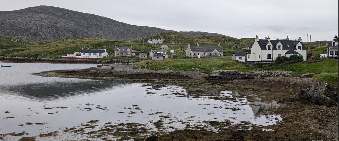
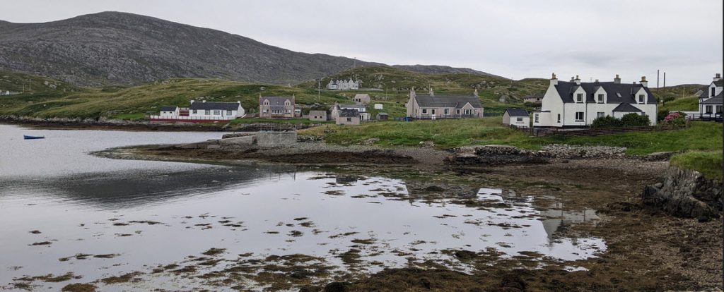
The island covers about 2.5 square miles and its main settlement is commonly referred to simply as the village. The terrain is classic east Harris: bare rock, short grass, peat, small freshwater lochs and low hills sitting close to the sea. There is very little of the broad machair scenery found farther west. Instead, Scalpay has a more enclosed maritime appearance, with rocky inlets and channels cutting into the coast and houses positioned around ground that could reasonably be described as difficult if people had not been living and working on it for a very long time.
Scalpay’s position explains much of its history. This is an island shaped by boats, fishing and access to the sea rather than broad beaches or large areas of fertile farmland. North Harbour remains one of the most obvious expressions of that history, with its working maritime character and long association with fishing and seafaring. Even for a first time visitor, the relationship with the water is difficult to miss.
The landscape also makes Scalpay feel larger than its map dimensions suggest. Roads bend around rock and lochs rather than cutting directly across the island, while the walking routes move through ground that is rougher than the modest elevations imply. You can cross Scalpay quickly by car, but seeing it properly takes longer.
Getting to Scalpay
Getting to Scalpay is unusually simple by Outer Hebrides standards. The Scalpay Bridge links the island directly with Harris, so visitors can drive, cycle or cross on foot without using a ferry. The bridge opened in 1997 and replaced the previous ferry link, changing everyday access between the two communities while allowing Scalpay to retain a distinct identity of its own.
For residents, the bridge changed access to services, work and the rest of Harris. For visitors, it means Scalpay can comfortably be added to a day around Tarbert and eastern Harris without creating another layer of transport planning. Tarbert is only a short drive away, so the island works particularly well for travellers staying around the ferry port who find themselves with half a day free and would rather walk towards a lighthouse than inspect the same souvenir shelf again.
The drive is part of the experience. Once across the bridge, the road moves between small lochs, houses, rocky ground and harbour water. Distances are short, but rushing makes little sense. Roads can be narrow, walkers and cyclists use the same routes and stopping places should be chosen with some care so that entrances, passing places and working access remain clear.
That last point matters because Scalpay is not a preserved tourist village. People live here, boats work from here and ordinary island life continues whether someone has arrived with a camera or not. Visiting considerately is not complicated: slow down, use proper parking areas where available and treat passing places as passing places rather than scenic car parks.
Eilean Glas Lighthouse
The main landmark on Scalpay is Eilean Glas Lighthouse, standing at the island’s eastern edge and looking out across the Minch. The striped tower has become the visual shorthand for Scalpay, and with good reason. The location feels properly exposed, with the lighthouse sitting above dark rock and open water far from anything that resembles an urban skyline.
The history is older than the present tower. The lighthouse was first established in 1789 under engineer Thomas Smith and was one of the first four lighthouse sites built in Scotland. The light was first shown in October of that year. The present tower was erected in 1824 under Robert Stevenson, part of the engineering family that became closely associated with Scottish lighthouse construction. The two broad red bands were later used as a daylight identification mark, producing the familiar red and white appearance seen today.
That history matters because Eilean Glas belongs to an early period of systematic lighthouse building around Scotland. In the late eighteenth century, this coastline was not simply picturesque and remote. It was dangerous working water used by fishing boats, merchant vessels and other shipping without anything resembling modern navigation equipment. A reliable light on Scalpay had a practical role long before visitors began walking there for the view.
It remains an impressive destination even for people with no particular interest in lighthouse engineering. The approach crosses exposed Hebridean ground before the tower gradually becomes the dominant feature ahead. On a clear day, the views extend across the Minch towards Skye and the mainland, while the surrounding sea makes the lighthouse site feel far more isolated than its actual distance from the village suggests.
There is no enormous visitor centre, multimedia presentation or sequence of retail opportunities waiting at the end. That is rather the point. Eilean Glas feels like a lighthouse where a lighthouse logically ought to be: on rough rock at the edge of a shipping route with a great deal of sea beyond it.
Walking on Scalpay
The Scalpay Heritage Walk is the best way to understand the island beyond its road and harbour. The circular route is around 13 kilometres, or eight miles, and generally takes about four hours at a steady pace. It crosses the island towards Eilean Glas Lighthouse and passes through a mixture of low rocky ground, moorland and loch country, with broad views towards Harris, Skye and the Scottish mainland.
Do not mistake the absence of mountains for an easy urban stroll. Scalpay’s highest ground reaches only a little over 100 metres, but the terrain matters more than the elevation. Wet ground, peat and uneven rock can slow progress, particularly after rain. A dry morning does not guarantee dry feet, and a forecast containing one small cloud icon should not be interpreted as a legally binding promise.
Proper footwear is worthwhile. Waterproof walking boots or sturdy trail footwear make the route much more pleasant than smooth trainers, particularly after rain. A waterproof shell belongs in the bag even when conditions seem settled because the exposed eastern side of Scalpay gives weather very little to bump into before it reaches you. Wind can make a modest temperature feel markedly colder around Eilean Glas.
The route rewards the extra effort by showing far more of the island’s interior. Small lochs sit between rocky ridges, while climbing the low ground around Beinn Scorabhaigh provides broader views north and south than the island’s modest height would suggest. The absence of trees and large buildings means a little elevation goes a long way here. Harris, the Minch and distant islands begin to arrange themselves around you, making Scalpay’s geographical position much clearer than it ever appears on a road map.
The heritage route also passes Loch an Duin, where remains associated with an old dun survive. This gives the walk another layer beyond lighthouse scenery. Scalpay has been occupied and used for far longer than the eighteenth century maritime history that dominates many visitor descriptions. The landscape is not empty, even where it looks that way from a distance.
Alternative walking routes use different combinations of paths and roads, so travellers should decide which route they intend to follow before setting out. The full Heritage Walk makes the best half day or full day option, while shorter outings towards the lighthouse are possible for visitors who do not want to complete the entire circuit.
Scalpay Bothy
Walkers heading towards Eilean Glas will also find Scalpay Bothy near the lighthouse. The simple shelter sits outside the lighthouse gate and provides somewhere to get out of the weather, sit for a while and read information about the area. That can feel disproportionately luxurious after an hour or two of walking into Hebridean wind.
There is one important practical distinction. Despite its name, Scalpay Bothy is not a conventional overnight mountain shelter. It is intended as a day refuge rather than sleeping accommodation, so anyone planning an overnight walking trip should arrange proper accommodation instead of arriving with a sleeping bag and discovering that the word “bothy” has been doing more work than expected.
As a daytime stopping place, however, it suits Scalpay extremely well. The shelter provides a chance to look back over the quay that once served the lighthouse and consider how much work was required to maintain a station in this location before road links and modern transport. The lighthouse may now be reached on a recreational walk, but its existence was originally supported by people who had to supply, maintain and operate an isolated maritime installation through Hebridean winters.
Harbours and Fishing Heritage
Fishing is central to Scalpay’s identity. The sheltered waters around the island made it a natural base for generations of fishermen and seafarers, and the relationship between the community and the sea remains visible around North Harbour and elsewhere along the coast. Boats, piers, working gear and harbour buildings make Scalpay feel quite different from an island whose waterfront has been converted entirely into visitor accommodation.
North Harbour is worth seeing even if you have no intention of setting foot on a boat. Working waterfronts often explain an island better than a formal display because they reveal what the place is used for now, not only what happened there fifty or a hundred years ago. Scalpay’s maritime history is not a decorative theme selected for tourists. It follows directly from the geography of a rocky island surrounded by productive inshore waters.
Fishing is not simply historical here either. Inshore fishing remains part of the wider economy of Harris, Lewis and Scalpay, with species such as crab, lobster and Nephrops associated with the local creel fishery. The importance of these fisheries is economic as well as cultural because small scale marine work remains closely tied to the viability of many island communities.
That economic connection changes how the coast should be viewed. The sea around Scalpay is simultaneously scenery, habitat and workplace. A harbour photograph may contain someone’s livelihood in the background. Creel fishing grounds are not empty water simply because a visitor cannot see anything on the surface.
The fishing heritage also helps explain why the island has such strong seafaring associations. Before the bridge, boats were not simply recreational objects or commercial equipment. They were part of the transport system connecting Scalpay with Harris and the wider islands.
Scalpay and Bonnie Prince Charlie
Scalpay has a connection with one of the most repeated stories in Scottish history. After the Jacobite defeat at Culloden in April 1746, Charles Edward Stuart, better known as Bonnie Prince Charlie, spent months moving through the Highlands and islands while avoiding government forces and attempting eventually to escape to the Continent.
The Old Manse on Scalpay occupies the site of a house associated with this period. The present building stands on the site of the Campbell house where Charles Edward Stuart was offered refuge during his escape after Culloden. The building standing there now is later rather than the exact eighteenth century house in which he stayed, an important distinction that sometimes gets lost when the story is shortened for visitors.
The story becomes more interesting when seen on the ground because modern transport makes the distances deceptive. Scalpay is now connected to Harris by a road bridge that can be crossed in minutes. In 1746, islands, sea channels and difficult country created obstacles, hiding places and transport problems that are hard to appreciate from a modern road map.
The heritage walk adds another local tradition to the story. A cave near Lag na Laire is said to have been used by Bonnie Prince Charlie while avoiding Hanoverian troops. As with many stories attached to the prince’s flight, local tradition and documented history have become tightly intertwined, but the association gives the walk a useful historical dimension beyond its views.
Scalpay’s Jacobite connection is therefore relatively small in the context of the whole 1745 rising, but it is a good example of how national history becomes local. Famous events rarely happen only in castles and battlefields. They also leave traces in houses, harbours, paths and stories on islands that seem peripheral until you understand the route people had to travel.
Gaelic, Community and Island Character
Scalpay should also be understood as a living Hebridean community rather than a collection of visitor sites. Gaelic remains part of the cultural setting of Harris and the Outer Hebrides, visible in place names and local identity even for visitors who do not speak the language. Names such as Sgalpaigh, Na Hearadh and the Gaelic names attached to lochs and hills are not decorative translations added for tourism. They belong to the way the landscape has been described and understood locally.
The bridge has made travel much easier, but it has not turned Scalpay into another suburb of Tarbert. The island retains its own identity and history while sharing many of the wider Outer Hebrides challenges involving population, housing, transport and year round employment.
That context is worth remembering when visiting. Small islands can look wonderfully quiet to someone staying for two nights while presenting much harder practical questions for the people who need year round services, housing and reliable transport. Tourism can contribute to the local economy, but it works best when visitors use local accommodation, food and services without treating residential areas as though the whole island were an attraction designed around them.
This is partly why Scalpay feels different from more famous Scottish destinations. It has not been rearranged to create a neat visitor circuit. Roads go where residents need roads. Harbours remain working spaces. Houses face whichever direction made sense when they were built rather than whichever direction improves a holiday photograph.
The result is less polished and considerably more interesting.
Wildlife on and Around Scalpay
The waters and coast around Scalpay are good places to spend time watching for Hebridean wildlife. Porpoises occur in the surrounding waters, while black guillemots and white tailed sea eagles can be seen in the wider east Harris and Scalpay area. The mixture of rocky coastline, open water and quiet inland lochs gives visitors plenty to watch if they are prepared to slow down.
The lighthouse walk adds seabirds to the mix. Puffins may occasionally be seen around suitable coastal sections in late spring and summer, while other seabirds use the cliffs and surrounding water throughout the year. Any wildlife claim needs the usual qualification: being in the correct habitat does not mean an animal is obliged to appear on schedule. Sea eagles have not signed a contract with the tourism board, and porpoises are particularly poor at respecting photography itineraries.
Still, the open coastline gives visitors plenty of time to watch. Carrying binoculars makes considerably more sense than relying on a phone camera at maximum digital zoom. Scan the sea periodically rather than staring only at the path, particularly from higher ground where more water is visible.
The same approach works with birdlife. A slow walk produces more sightings than marching towards the lighthouse with the determination of someone late for an appointment.
Photography on Scalpay
Scalpay suits photographers because the visual interest is concentrated without being repetitive. The red and white bands of Eilean Glas provide an obvious focal point, but the better photographs often come from combining the lighthouse with dark rock, changing sea colour and the distant outline of Harris or Skye.
Weather is particularly useful here. A perfectly clear blue sky can look pleasant, but broken cloud and passing showers create much more dramatic light across the Minch. One hillside can sit under heavy grey cloud while another catches direct sun. Five minutes later the arrangement has changed completely.
The harbours provide a different type of photography. Fishing boats, stone piers, reflections and working equipment create smaller scenes than the lighthouse coastline. These are worth taking slowly, and normal courtesy applies around people working. A harbour is not a studio, and a person hauling equipment does not automatically become part of somebody else’s portrait session.
Early morning and evening can produce softer light when conditions cooperate, although long summer daylight means “evening” can become a fairly elastic term. Visitors staying overnight gain an advantage here because they can photograph Scalpay after most day trippers have returned across the bridge.
Rain does not necessarily ruin the island photographically either. Dark wet rock, low cloud and muted water arguably fit Scalpay rather well. The main difficulty is keeping the front of the lens dry.
What Is Scalpay Like to Visit?
Scalpay works best for travellers who are comfortable with an island not trying terribly hard to entertain them. There are no sprawling resort complexes or streets packed with attractions. Instead you get narrow roads, working harbours, scattered homes, rock, moorland, lochs and a lighthouse walk that ends beside open water.
That makes Scalpay particularly good for slow travel. Weather changes the island constantly. Sunshine can turn dark water blue within minutes, while low cloud can make the same stretch of coastline look far more severe. The island does not require a strict sequence of sights. A drive can become a harbour stop, which becomes a short walk, which becomes half an hour watching changing light over the water.
It also makes a useful contrast with western Harris. The west coast is famous for huge white beaches such as Luskentyre, extensive sand and machair. Scalpay feels rockier, tighter and more maritime. Visit both and Harris starts to look much less like the collection of beach photographs used to advertise it. The geology, exposure and settlement patterns change markedly over comparatively short distances.
That contrast is one of the best reasons to add Scalpay to a Harris trip. It does not compete with Luskentyre or the mountains of North Harris by trying to provide a smaller version of them. It provides something different.
Food, Accommodation and Practical Facilities
Scalpay has accommodation and places to eat, but visitors should approach services as they would anywhere in the Outer Hebrides: check current opening arrangements rather than assuming that everything operates long urban hours throughout the year. Seasonal opening, staffing and local circumstances can affect availability, especially outside summer.
Accommodation close to the island’s harbours makes Scalpay a practical base for exploring Harris as well as a destination in its own right. Tarbert is only a short drive away, while the bridge gives visitors easy access to the rest of Harris without having to plan around another ferry.
Staying on Scalpay has a different feel from making a short afternoon visit. Once traffic drops and visitors leave, the harbour and lochs become the main features again. For walkers or photographers that extra time is valuable because it removes any temptation to fit Eilean Glas, the harbour and the rest of Harris into one hurried sequence.
Anyone planning the Heritage Walk should carry food and water rather than assuming refreshments will appear conveniently beside the path. The route crosses open ground and the lighthouse area should be treated as a walking destination, not as a conventional serviced visitor attraction.
How Long Should You Spend on Scalpay?
A few hours is enough to drive around Scalpay, stop at the harbours and get a basic impression of the island. That works well if Scalpay is being added to a wider Harris itinerary, particularly when time is tight.
A full day is better if you want to complete the Scalpay Heritage Walk and spend time around Eilean Glas. The usual four hour estimate covers walking rather than every photography stop, lunch break and period spent wondering whether that shape over the water is a sea eagle. Allowing more time makes the day far more relaxed.
An overnight stay makes sense for photographers, walkers and travellers who prefer smaller settlements to being based in Tarbert. The permanent road link means staying on Scalpay does not leave you dependent on an inter-island ferry each time you want to explore Harris. You can cross the bridge and continue north, west or south without building the day around sailing schedules.
For a first visit, one full day is probably the sweet spot. It is enough to walk, see the lighthouse and spend time around the harbours without attempting to turn every minor road into a separate attraction.
Best Time to Visit Scalpay
Late spring and summer provide long daylight hours and are well suited to walking, wildlife watching and photography. The additional daylight gives considerable flexibility on the lighthouse route, while summer offers the best chance of seeing seasonal seabirds around the coast.
Autumn can be excellent for darker colours and more dramatic weather, although conditions become less dependable. Winter gives Scalpay a much harsher appearance and very short daylight needs to be taken seriously when planning longer walks. Whatever the season, wind deserves as much attention as rain because the eastern ground around Eilean Glas is exposed.
There is no month in which Hebridean weather becomes completely trustworthy. A clear forecast can still produce showers, and conditions on exposed ground can feel different from those around the sheltered harbour. Carry waterproof clothing and enough warm layers to deal with a change.
In other words, pack for Scalpay rather than for the version of Scalpay you hope to photograph.
Scalpay as Part of a Harris Itinerary
Scalpay works particularly well when paired with eastern Harris and Tarbert. Visitors arriving through Tarbert can cross to the island without committing an entire travel day, while people touring Harris by road can use Scalpay as a marked change from the west coast beaches.
A useful rhythm is to give Scalpay its own half day if you are only driving and visiting the harbours, or most of a day if Eilean Glas is included on foot. Trying to squeeze the full Heritage Walk between Luskentyre, South Harris and a ferry departure is possible only if your preferred holiday style involves repeatedly checking the time.
The bridge also means bad weather does not trap visitors in the same manner that a cancelled island ferry potentially can elsewhere. If conditions are unsuitable for the lighthouse walk, Scalpay can be shortened to a scenic drive and harbour visit before continuing around Harris.
That flexibility is one of the island’s strongest practical advantages.
Is the Isle of Scalpay Worth Visiting?
Yes, particularly if you are already visiting Harris. The bridge makes Scalpay easy to reach, yet the island feels considerably more removed than the short crossing suggests. Eilean Glas alone justifies the detour, but the better reason to visit is the combination of maritime history, rough walking, working harbours and a community that has not been repackaged into a single tourist attraction.
Scalpay is small enough to explore without turning the day into a logistical operation, but substantial enough to reward visitors who get out of the car. The lighthouse gives the island an obvious destination, yet the lochs, harbours and low rocky ground between the bridge and Eilean Glas provide most of its character.
It also corrects one of the easier misconceptions about Harris. The Outer Hebrides are not simply white beaches and turquoise water. On Scalpay, the scenery is harder edged: exposed rock, dark lochs, fishing boats and a red and white lighthouse looking across the Minch.
If your idea of the Outer Hebrides involves windswept paths, working harbours, empty stretches of coast and a lighthouse that has been watching shipping since the eighteenth century, the Isle of Scalpay gets very close to the brief.